
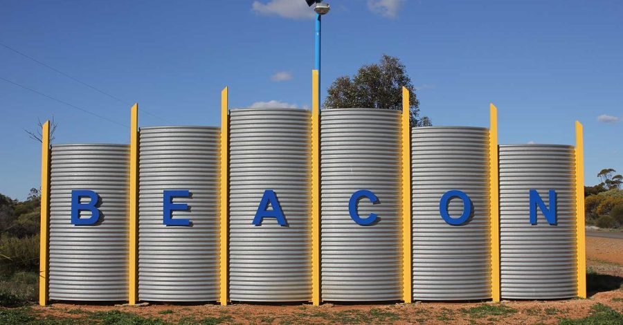
What a difference a day makes.
We pulled up stakes late this morning after hugs and handshakes with part time travel mates Steve and Wendy, a quick shop for staples, then hit the road under sunshine and a few gusty winds — nothing dangerous, just enough to keep a firm grip on the wheel. An hour later we rolled into Beacon having battled the last few kilometres through driving rain, lightning, and conditions that had done a complete about-face. Wheatbelt weather doesn’t mess about.
The road through was blacktop the whole way and in decent nick, especially considering the sheer number of grain trucks that thunder across these roads every harvest season. And there were plenty of paddocks along the route, obviously seeded late, that will benefit enormously from that rain — if it keeps up. Fingers crossed for the farmers out here.
Wialki: the town that almost wasn’t called Wialki
The first dot on today’s map was Wialki, a tiny townsite tucked between Beacon and Bonnie Rock in the eastern Wheatbelt, about 25 km east of Beacon itself. Blink and you’ll miss it — the population sits somewhere around 45 — but it has a really good origin story.
Wialki began life as a railway siding, planned in 1929 as part of the Burakin to Bonnie Rock line extension. When it came time to name the place, the district surveyor actually recommended calling it “Datjoin.” The Railway Department overruled him and went with Wialki instead, an Aboriginal name for a nearby soak. The station was officially named in 1930, and the townsite was gazetted in 1933.
Like so many Wheatbelt towns, Wialki grew up around wheat. The surrounding country produces wheat and other cereal crops, and the town became a Cooperative Bulk Handling receival site — a role it still plays today. A second bulk bin went up in 1940, built just as the first one filled to capacity, which says a lot about how good the seasons were back then.
Datjoin: the name that found a home anyway
Here’s the fun bit of trivia: even though “Datjoin” lost out to Wialki as the town name, it didn’t disappear altogether. Head east of Beacon and you’ll find Datjoin Rock, along with Datjoin Well and a picnic area, tucked among the granite outcrops that this part of the Wheatbelt is famous for. In wildflower season these spots — along with nearby Tampu Well — make for a lovely detour, with the granite catching runoff into gnamma holes that pioneers and travellers alike have relied on for generations.
It’s a nice reminder that out here, place names have long memories, even when the paperwork doesn’t go the way you’d expect.
Datjoin Rock has another name too, one with a proper bush yarn behind it: Brockman’s Hideout. Back in 1970, a local man named Lionel Brockman — on the run after breaching his parole — holed up with his wife and twelve children in the caves around the base of the rock, living off food stashed around the area and the odd “borrowed” vehicle from around Beacon. He evaded police for months, from May right through to September, before one of his camps was finally discovered out near the vermin-proof fence.
When police and search parties closed in on Datjoin, they found only his wife and the ten youngest children waiting there — Brockman and his two eldest sons had already slipped away, and weren’t caught until some time later, over near Perenjori. These days the caves are a far more peaceful spot: a favourite for picnickers and orchid-hunters in wildflower season, with barely a hint of the manhunt that once played out around them.
Beacon: the last town before the bush takes over
And then there’s Beacon itself, our stop for the night, and the farthest north-easterly town in the entire Wheatbelt. Beyond it, the country shifts from cropping land to marginal grazing and then to uninhabited bush — Beacon really does feel like the edge of the wheat frontier.
The area’s European history goes back to 1836, when explorer John Septimus Roe first passed through. Shepherds grazed the open grasslands here in the 1870s, followed by sandalwood cutters in the 1880s, and by the late 1920s the land was being carved up into farming blocks as the railway pushed out to service them. The town was originally known as Beacon Rock, but was renamed simply Beacon in 1931 to avoid confusion with another railway siding of a similar name.
A store, post office, bakery and butcher soon followed, and by the 1930s sporting clubs — footy chief among them — were already up and running. The local Bombers would go on to become a Central Wheatbelt Football League powerhouse decades later, taking seven premierships in a row through the 1990s.
These days Beacon is home to around 100 to 120 locals, with more scattered across the surrounding farms. It punches above its weight for a town this size: a museum at Beacon Central, a Men’s Shed packed with lovingly restored vintage tractors and machinery, a botanical park showcasing the local wildflowers, and the Beacon Country Club for a well-earned drink at the end of a long day on the road. Add in the granite formations at Billiburning Reserve and Datjoin Rock nearby, and it’s easy to see why this stretch of the Wheatbelt Way draws travellers who’d otherwise never have heard of it.
The rain was still hammering down when we pulled in, so heavy we simply sat in the car for a good ten minutes waiting for it to ease off enough to make a run for the van and get set up. An hour later, sunshine again — as if the whole storm had never happened — and we finally got to finish setting up properly and sort out power for the one thing that actually matters: coffee.
Tonight, though, we’re just grateful to be parked up, dry, and out of the lightning — even if it did make for a dramatic final approach. Tomorrow, maybe, perhaps, we might push on.

Leave a Comment